
Overview
This academic project aimed towards creating a more streamlined wayfinding system concept for a popular tourist attraction that aligns with the current identity and aesthetics of the location, and focusing on elevating the clarity and ease of navigation for the target audience.
This included researching the current signage system at the Pier, conducting virtual site analysis through available online sources, as well as introducing a signage and wayfinding manual for the final concept.
This hypothetical project is for academic purposes only.
Role
Researcher | Strategist | Visual Designer
Duration
2 Weeks (2019)
Team
Solo Project
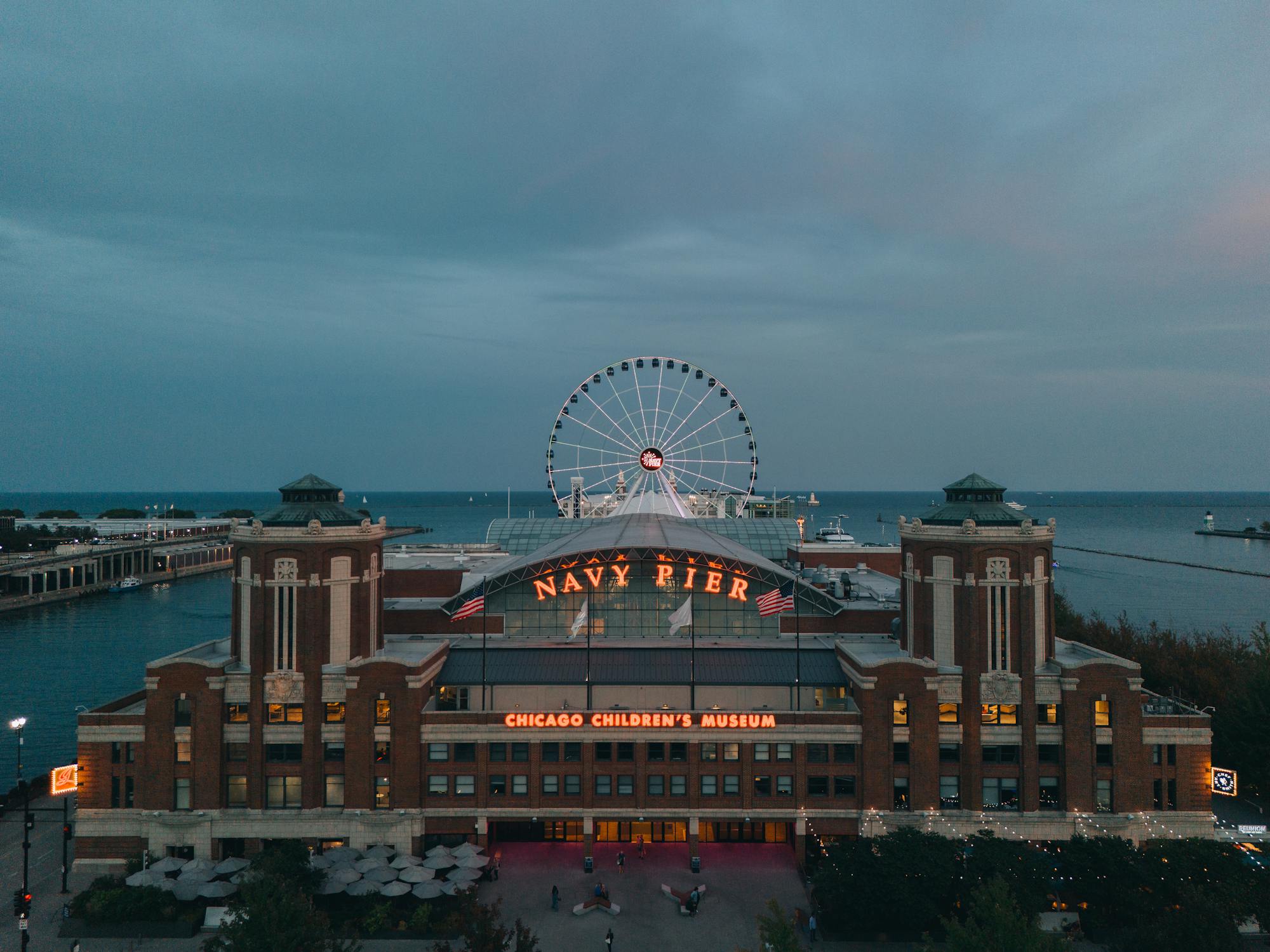
The approach
Given the remote and cross-country nature of this project, my approach was rooted in extensive secondary research. I began by analyzing the site’s historical context to ground the project in its local narrative. This was followed by mapping the distribution of amenities at the Pier to better understand its spatial layout. These insights laid the foundation for crafting strategic wayfinding goals, designed to enhance the navigation experience for both tourists and local visitors.
50 Acres
OF ATTRACTIONS
9 Million
VISITORS ANNUALLY
3,300 ft.
LONG PIER
My thought process
Designing a conceptual wayfinding system remotely challenged me to showcase my versatility across platforms. Through ideation sessions, mood-board development, and in-depth conversations with signage professionals, I explored material choices, manufacturing techniques, and critical environmental considerations - such as geographic location, climate conditions, color psychology, and the full spectrum of wayfinding product options.
This holistic approach led to a solution that balances visual appeal with functional clarity.
Phase 01
Site analysis
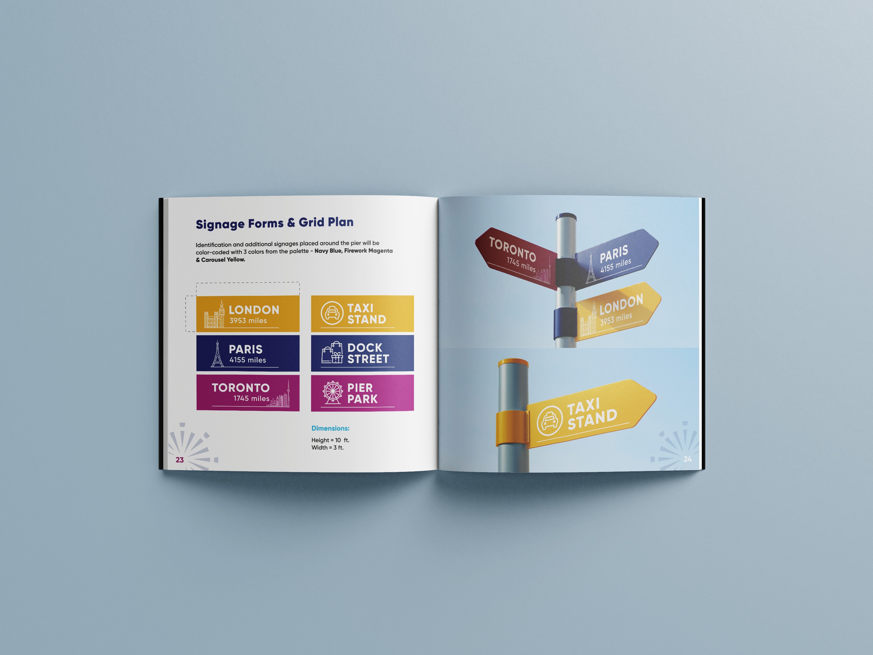
In order to enhance the navigational experience within the Pier, I implemented the strategy of segmenting the site into distinct zones.
Each zone is designated with a specific color scheme, which is consistently reflected in the signage placed within its boundaries.

Phase 02
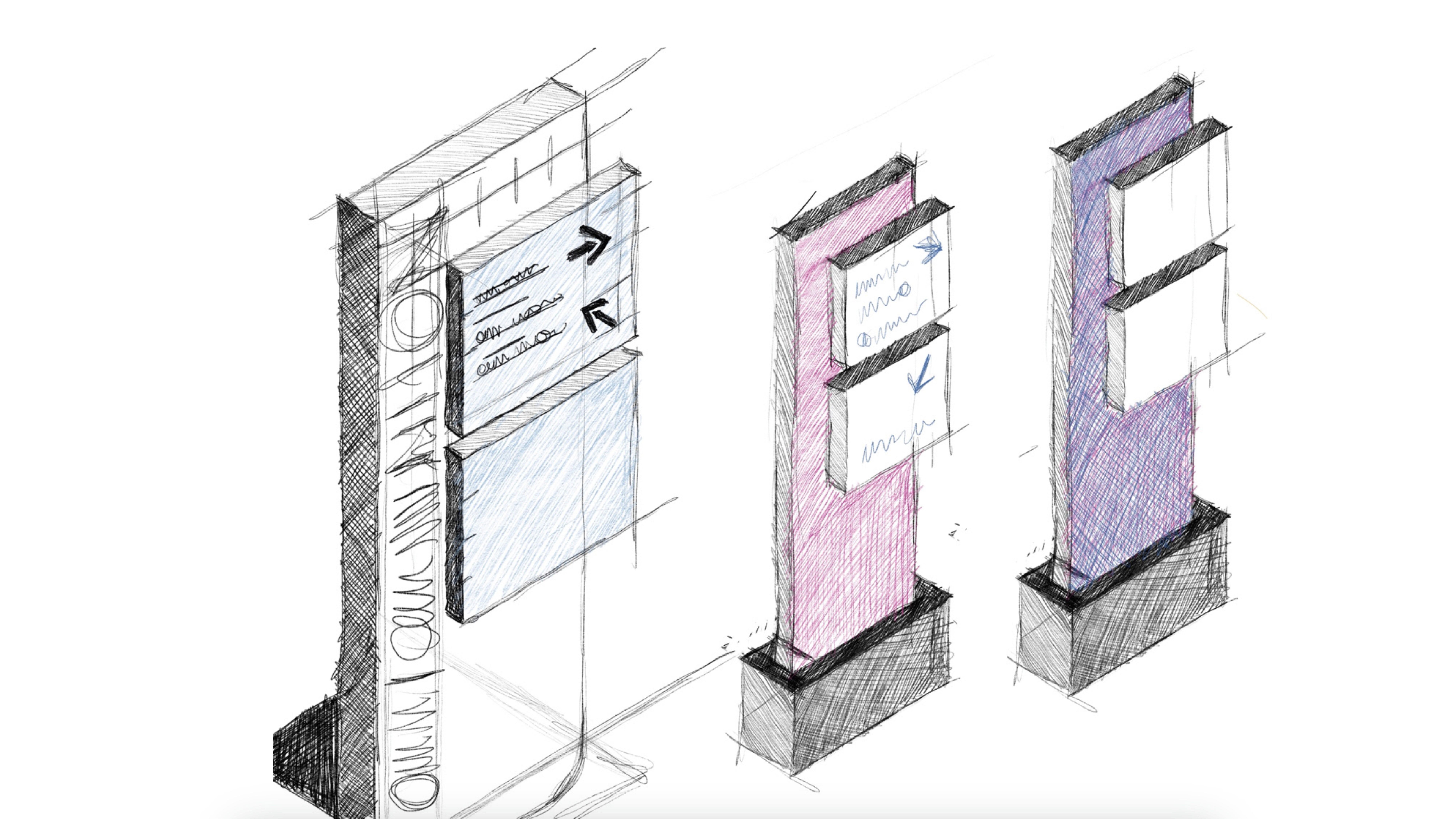
Ideation
Following the comprehensive gathering of secondary data encompassing area demographics, Pier attractions, target audience personas, and analysis of the current signage within the location, I began conceptualizing by translating my findings into preliminary sketches for the envisioned signage systems.
Phase 03
High fidelity prototypes
Five distinct designs were crafted to symbolize designated zones throughout Navy Pier, strategically aligned with its array of attractions.
Leveraging a color-coded system aligned with the brand identity facilitates seamless navigation for tourists that elevates their experience as they explore the diverse locales within the Pier.

Understanding the ergonomics
I outlined the ergonomic structure of a wayfinding system designed to enhance spatial navigation at Navy Pier by showcasing four key signage types - Secondary Directional Signage, Identification Signage, Primary Directional Signage, and an Orientation Map Standee. Each sign is scaled to human height (8.5 feet), ensuring optimal visibility and accessibility. The system is color-coded and icon-driven to guide diverse audiences with clarity and efficiency.
From guiding visitors to essential amenities to clearly marking zones and offering comprehensive spatial overviews, the signage strategy balances functional direction with visual coherence, ultimately supporting a seamless, intuitive user experience throughout the space.
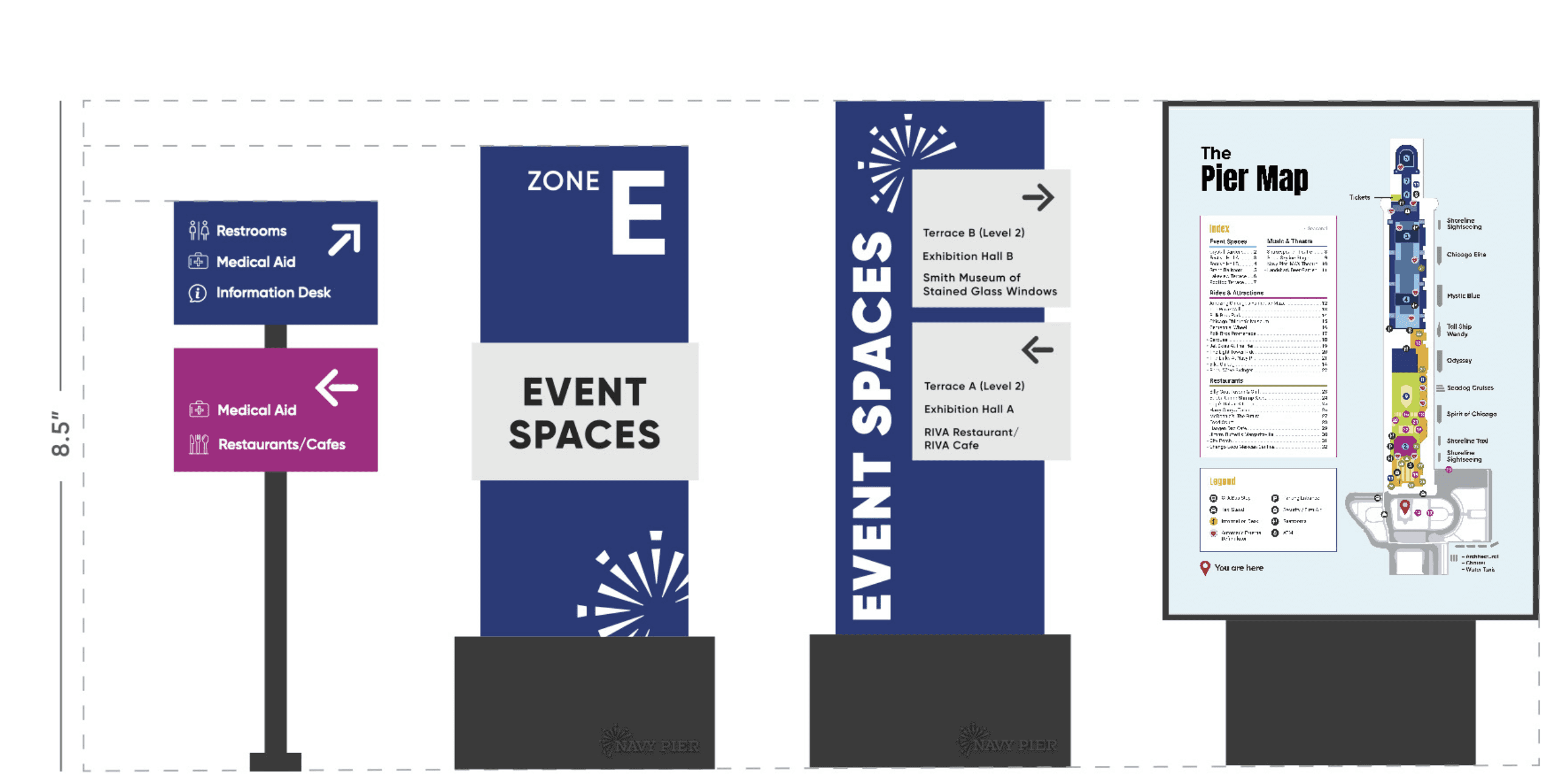
Secondary
Directional
Signage
IDENTIFICATION
Signage
PRIMARY
DIRECTIONAL
Signage
ORIENTATION
MAP STANDEE


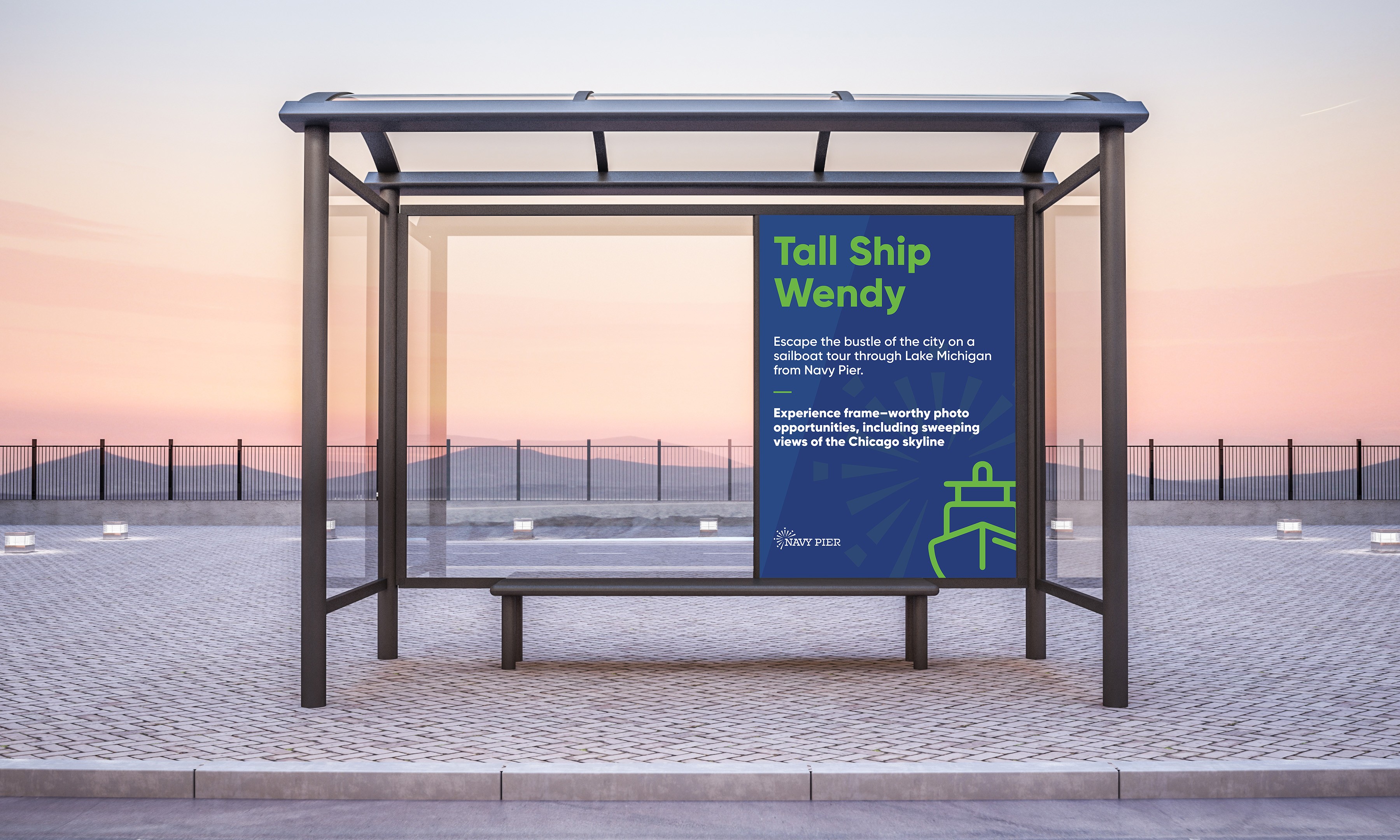
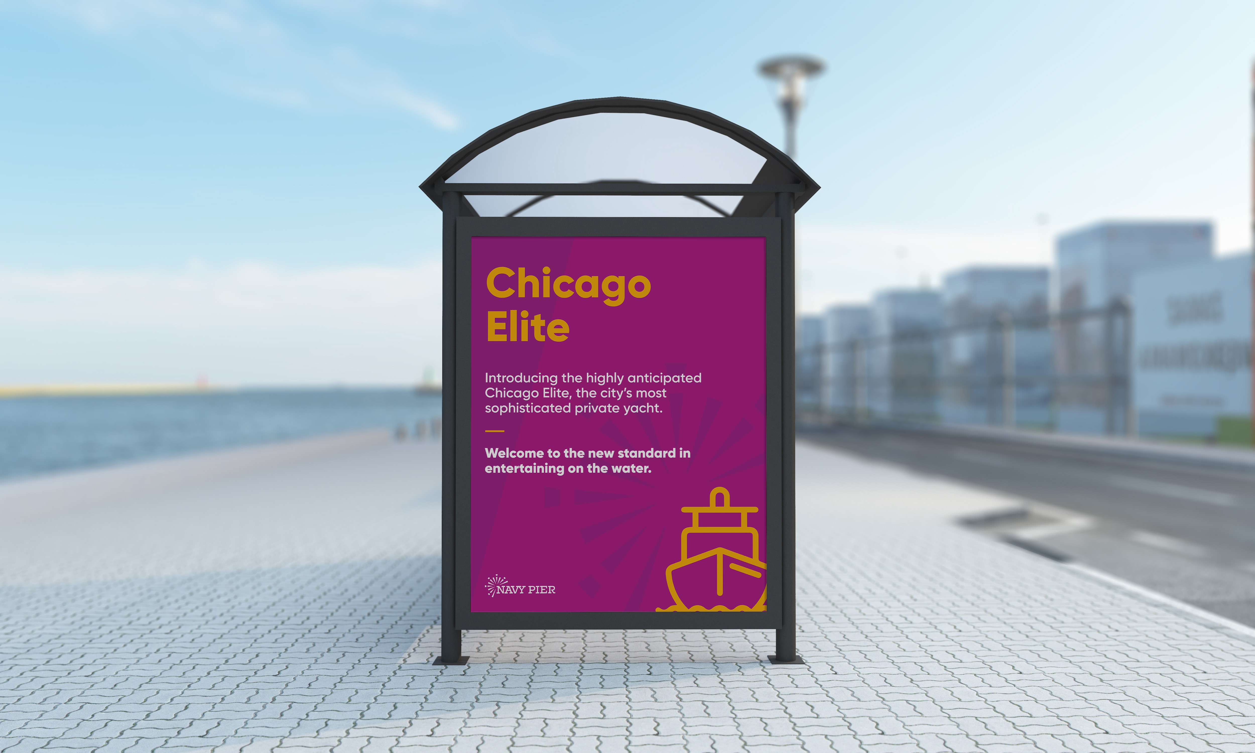
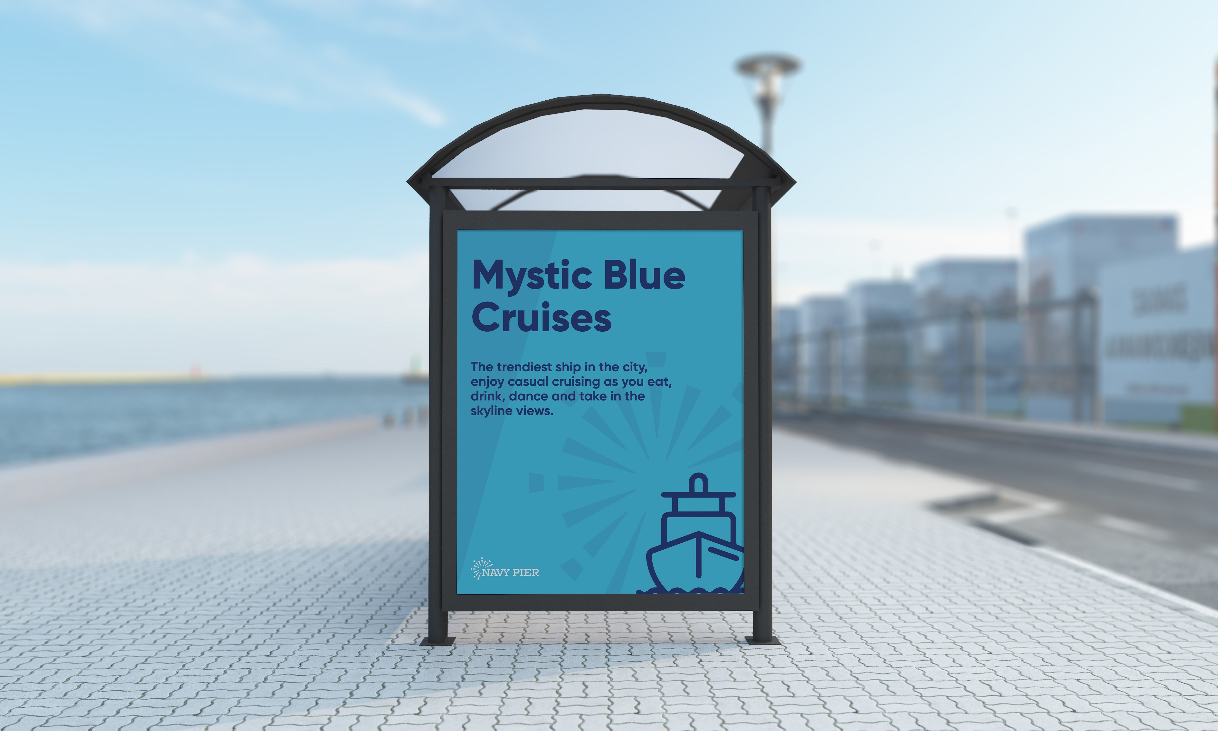
Navy Pier Cruises
The Pier provides various cruise rides along its dock, yet it falls short in providing ample seating and waiting facilities for its visitors. This deficiency in accommodations detracts from the overall experience, leaving guests without comfortable places to rest and wait before embarking on their cruise adventures.
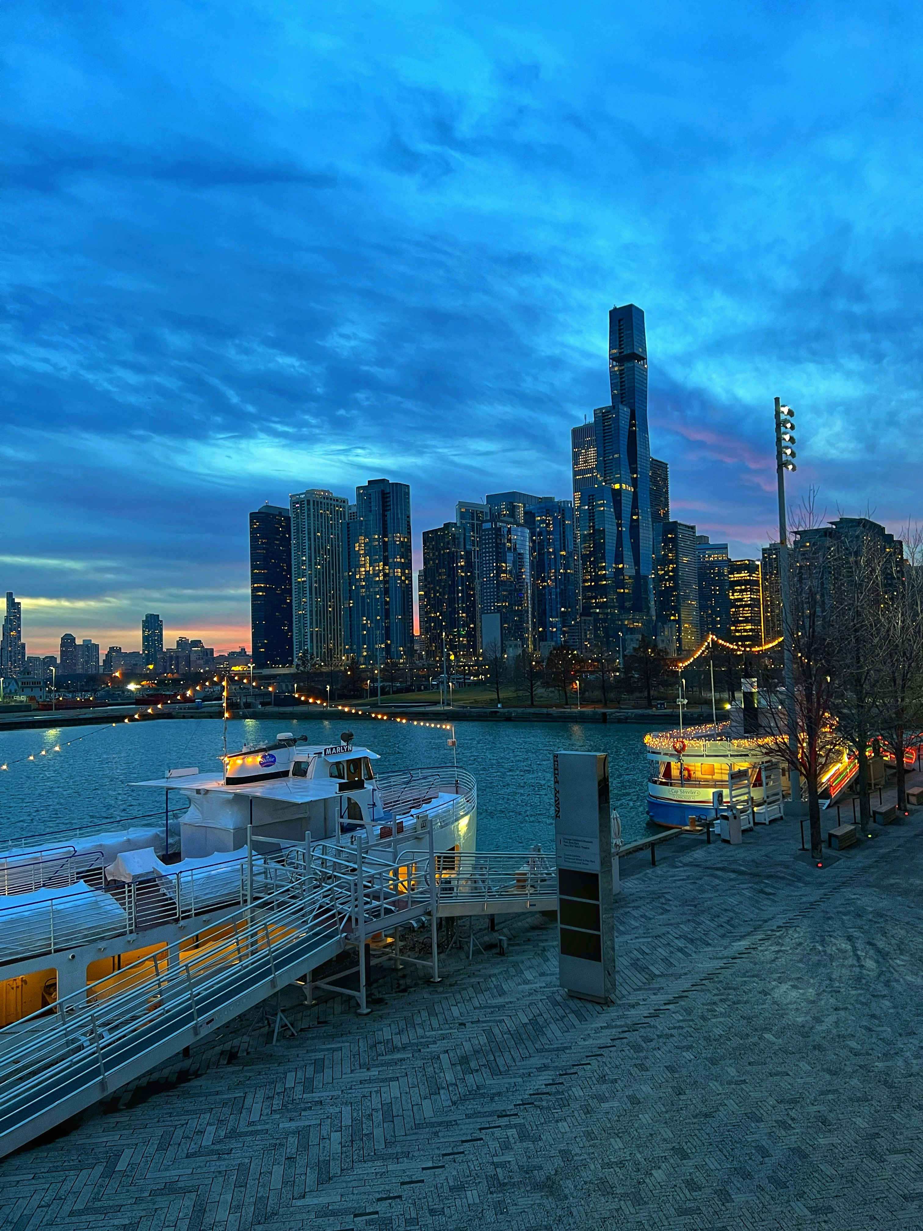
Redesigning Cruise Stands
The Pier provides various cruise rides along its dock, yet it falls short in providing ample seating and waiting facilities for its visitors. This deficiency in accommodations detracts from the overall experience, leaving guests without comfortable places to rest and wait before embarking on their cruise adventures.
The signage manual
The signage manual curated for the wayfinding system concept outlines the design, placement, and usage specifications for signage within Navy Pier, ensuring consistency and effectiveness in visual communication.
This includes information on materials, visual language, as well as the importance of this solution for the site.

The Pier brochure
Navy Pier offers a diverse and eclectic range of experiences and activities that ignite one's imagination, and allows your spirit to soar.
As millions of tourists and local citizens visit the Pier, a well designed brochure would assist in planning visits, smoother navigation and a quick overview with everything the attraction has to offer.

©2025 by Tanvi Lakdawala. All rights reserved.